
The mobile code module sends HTML code for mobile devices to a local web server.This way the CruiseShow
information can be browsed from any mobile device through the existing WLAN infrastructure without
the need of installing a dedicated app.
On ocean going cruise ships the mobile code module creates maps with current ship’s
position in several zoom levels, along with navigational and weather data in
all languages which are activated in the base module.
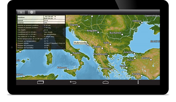
Device-independent code providing nautical information and maps on a tablet PC.
On river cruise ships a topological map including river kilometers will automatically scroll to current ship’s position. Points of interest along the riversides are displayed and linked to the according Wikipedia articles.
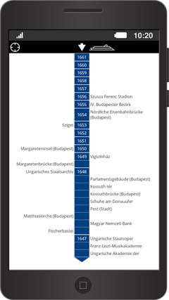
Topological river map with river kilometres and Wikipedia links to points of interest nearby.
[ Contact ]
[ Privacy ]
[ Imprint ]
T: +49 (0)8363 6025
T: +49 (0)8363 6025